
Downloading smartphone app can show better Waze to travel in Oxford
Waze can be downloaded for Android and iPhones via https://www.waze.com/en-GB/
PEOPLE travelling in and around Oxford can now keep themselves and others moving more easily thanks to a new partnership between the county council and a team of hi-tech innovators.
Oxfordshire County Council has joined forces with Waze, the free crowdsourced traffic and navigation app, in a data-sharing link-up that is unique outside of London.
The two have come together to form the first Connected Citizen Partnership outside of the UK capital which will see the council provide traffic data to help power Waze - the world's largest community-based traffic and navigation app.
Launched in October 2014 with 10 city partners, the program has expanded to more than 175 global partners.
The Waze Connected Citizens Program (CCP) is a free two-way data exchange which can help councils to manage the traffic network more effectively for the benefit of all users.
Up to the minute travel information
The partnership is mutually beneficial with Waze providing real-time, anonymous, incident and slow-down information directly from the source – drivers themselves.
The council will add real-time and advance information on things such as roadworks, accidents and road closures.
The app includes a safety feature which prevents drivers from using it while on the move, although passengers or motorists who have parked up can send information when they choose.
A better transport system for Oxfordshire
In 2016 the county council’s automatic traffic counters recorded more than 1,000,000 vehicle movements during an average days peak periods. This figure gives some idea of the volume of vehicles making their way into, around and out of the city each day,
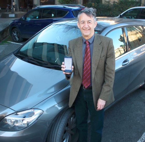
County Councillor David Nimmo Smith (above left), Cabinet member for transport, said: “We have been working hard to build a better transport system for Oxfordshire for many years and will continue to build the infrastructure that is needed to support our thriving county.
“What Waze can do is link up the thousands of drivers to work with us to give a complete and helpful picture of what is happening on the roads at any moment in time.
“This sets the scene for working in a different way and looking to different data sources to provide more accurate travel planning data, in turn reducing congestion.
“For instance if you know a particular route is very busy, or there’s been an accident or roadworks you can decide to use a nearby park and ride and avoid congestion. One bus could potentially take up to 75 cars off the roads and Waze could be one way for drivers to see why bus travel could sometimes be a better option for them.
“The app can also learn about when could be best for you to make your journey to avoid peak times, again avoiding congestion.”
Unprecedented traffic knowledge
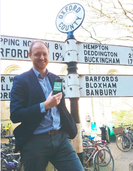
Finlay Clark (above right), head of Waze UK said: "We're delighted to welcome Oxford into the Connected Citizens Programme, meaning the council can now tap into our unprecedented knowledge base of traffic and real time driver insights to improve congestion in the local area.
“Oxford is known throughout the world for innovation, and this partnership means the Council will be not only following in the footsteps of cities like Rio de Janeiro, Mexico City and Boston, who have all benefitted from this data share alliance, but will also have direct contact with the leaders of those organisations to learn from them and share how Oxford is tackling urban mobility."